The Alpes-Maritimes is a wonderful place for dog owners who love hiking: in under an hour's drive from Antibes or Nice, you go from the Mediterranean coast to alpine summits above 2,700 metres. The trails are varied and well waymarked thanks to the Randoxygène network of the Conseil Général 06, and the vast majority are open to dogs.
In this article I have chosen 11 routes spread across the whole département, from the most accessible to the most demanding. For each one you will find the essentials: distance, ascent, level required, access and specific advice for hiking safely with your dog.
Difficulty levels — Randoxygène network
Selection — 11 routes
Baou des Blancs et des Noirs
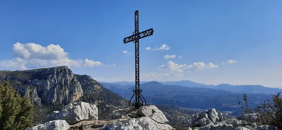
Summit of the Baou — view over the Préalpes and the Côte d'Azur
Two emblematic limestone peaks overlooking Vence. They are less busy than their neighbour the Baou de Saint-Jeannet but offer identical panoramas over the Côte d'Azur. The first climb is steep over rocky ground, while the rest of the loop is easy and pleasant. From both summits you get 360° views of the sea, the snow-covered Mercantour and the villages of the hinterland.
Access: from Vence, take the route du Col de Vence. About 1.5 km after the Château Saint-Martin, there is a small roadside car park on the Coursegoules side (waymark no. 129). Allow 40 min from Nice.
Baou de la Gaude
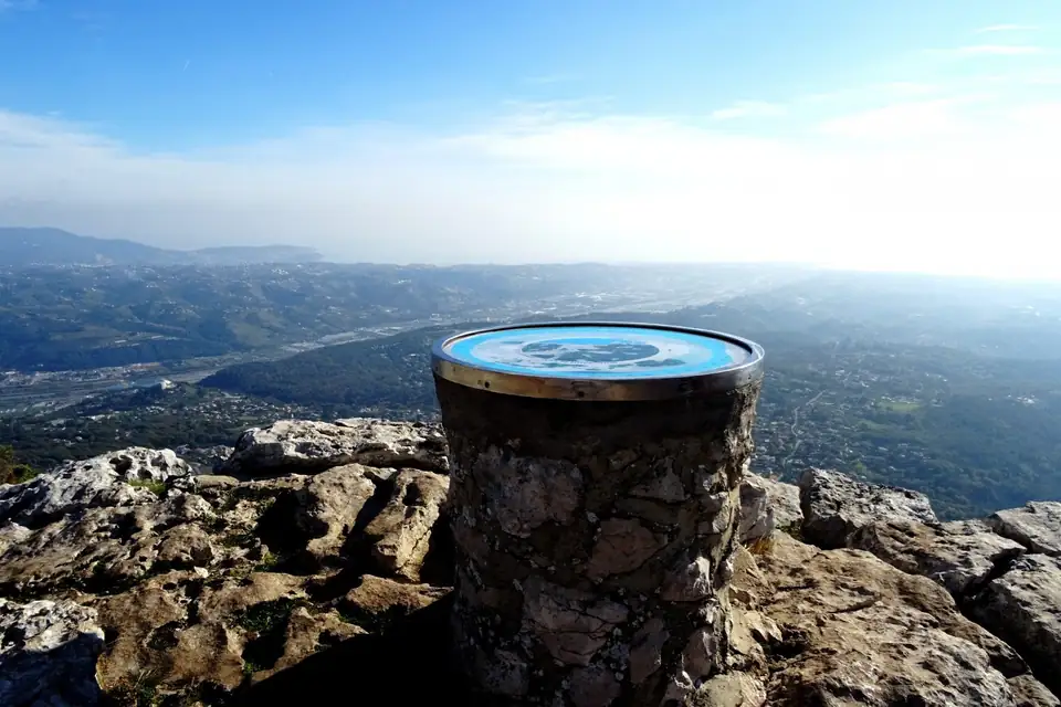
Viewpoint indicator at the summit — panorama over the Riviera plain
A baou with a distinctive profile overlooking the lower Var valley, with exceptional views over the Riviera plain, the sea and the surrounding hills. A varied panoramic route through scrubland, oak woods and limestone ridges. The ascent is considerable but well spread over the whole route.
Access: from Nice or Cagnes-sur-Mer, reach La Gaude via Saint-Jeannet. Start from the Côtes district (parking available).
Puy de Naouri
Short but rewarding, this circuit around the Puy de Naouri offers an exceptional viewpoint over the western Côte d'Azur. The massif shows many traces of human occupation (terraces, bories, sheepfolds) and even prehistoric Bronze Age remains at the summit. Ideal for half a day with your dog.
Access: from Tourrettes-sur-Loup, drive to the hamlet of Le Caïre (car park at waymark no. 175). About 30 min from Nice.
Observatoire de Calern
An extraordinary karst plateau: the Observatoire de la Côte d'Azur (where lasers are fired at the Moon every day) sits alongside an intact pastoral world of Roman roads, bories, potholes and sheepfolds. The Aven des Baudillouns, protected by a fence, drops more than 80 metres. A wild, away-from-it-all atmosphere is guaranteed.
Access: from Antibes or Nice, drive to Châteauneuf-Grasse, then Gourdon and Caussols. Car park in the centre of the village (waymark no. 117). About 1h from Antibes.
Plateau de Caussols
At over 1,000 metres, the Caussols plateau is a vast karst landscape that is home to thousands of orchids in spring and the famous Caussols tulip, found nowhere else in the world. The terrain is dotted with sinkholes, the embut (a chasm where the water disappears), sheepfolds and age-old farming and grazing traces. A bright, accessible hike, perfect with a dog in any season.
Access: same as for the Observatoire de Calern, with parking in the village or at the embut. There is no phone signal in the village, so plan your route in advance.
Madone d'Utelle circuit
From the hilltop village of Utelle, this loop passes through olive groves and historic terraces before reaching the Madone sanctuary (founded in AD 850), perched at 1,188 metres. 360° views take in the coast, the Var valley, the Mercantour and the hinterland of Nice. The sanctuary is temporarily closed for building work, but the summit panorama is well worth the trip.
Access: from Nice, go up the Var valley (RM6202) to Plan-du-Var, then the Vésubie to Le Cros d'Utelle. Drive up to Utelle village (parking).
Valberg planetary trail
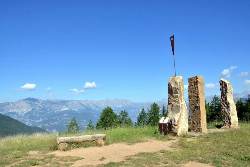
The monolith artworks of the planetary trail, with a view of the Mercantour peaks
A one-of-a-kind educational trail in the Alpes-Maritimes: the solar system reproduced at a scale of one in a million (1 m = 1 million km). From Mercury to Neptune, the route passes through larch forests, runs beside two lakes and ends at the summit of the Anguilliers with 360° views over the peaks of the Mercantour National Park. Fun for everyone, unforgettable with a dog!
Access: from Nice, go up the Var valley, then through the Gorges du Cians (RD28) to Beuil, then Valberg. Start at the ski lifts in the centre of the resort. Also reachable by bus (line 770 from Nice).
Cime de Rocca Sièra
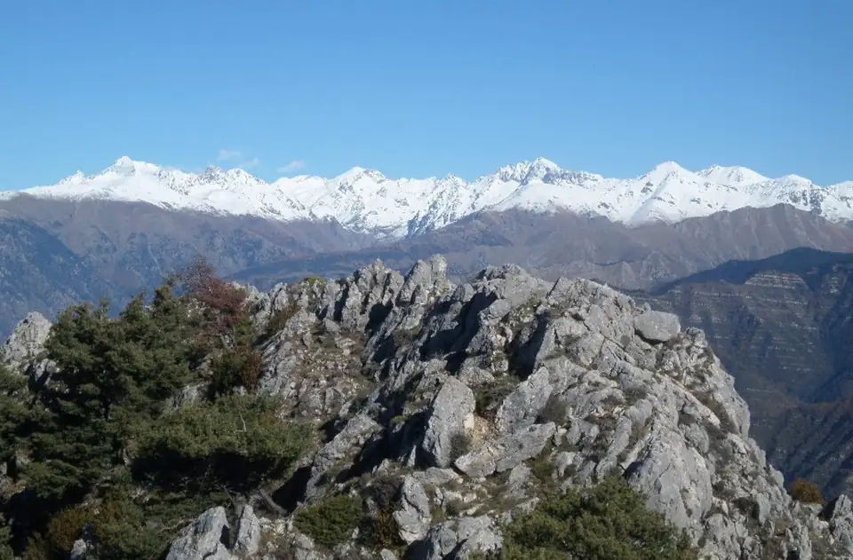
View from the Rocca Sièra ridge over the snow-capped Mercantour peaks
A natural viewpoint with steep terrain overlooking the Paillon and Vésubie valleys. The climb from Calençon is technical towards the end but is rewarded with an exceptional 360° panorama, from the Mercantour all the way to the sea. Best done from April to December, as snowfields make the last few metres tricky in winter.
Access: from Nice, go up the Vésubie. Start from the hamlet of Calençon (Duranus), waymark no. 122a. Waymarked trail (yellow rectangles).
Cime du Cheiron
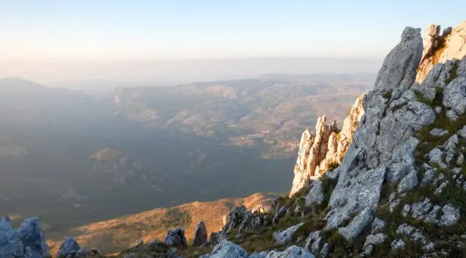
The limestone ridges of the Cime du Cheiron (1,778 m), the highest point of the Préalpes d'Azur
The highest point of the Préalpes de Grasse and of the Préalpes d'Azur Regional Nature Park. This limestone mountain with jagged ridges separates the Estéron and Loup basins, only 20 km as the crow flies from the Mediterranean. A magnificent panorama: Côte d'Azur, Îles de Lérins, Italian summits. Several options depending on your level: from Gréolières village (long option) or from the Gréolières-les-Neiges resort (shorter option, +414 m).
Access: from Nice, take the A8 to Cagnes-sur-Mer, then the Gorges du Loup (RD6, RD3, RD2) to Gréolières. For the short option, continue to the Collet car park (Gréolières-les-Neiges resort).
Baisse de Peira Cava
At the gateway to the Mercantour National Park, starting from the village of Moulinet, this circuit follows the GR 52A and the Beccas track to reach the Baisse de Peira Cava. A renowned high forest, a passage past the Malpertus cave, and wild, little-visited alpine scenery. Reserved for sturdy, well-trained dogs.
Access: from Nice, go up the Paillon valley to Moulinet (village car park). Allow 1h15 from Antibes.
Tête de l'Autaret
The great adventure of the département. On the French-Italian border ridge, this summit in the heart of the Mercantour combines military remains (blockhouses), wild alpine scenery and spectacular views of the Alps. The climb from the hamlet of Douans via the Lagarot and the Pas de Colle Longue is long and sustained, with no major technical difficulty. One slightly exposed section (~50 m) just before the summit.
Access: from Saint-Étienne-de-Tinée, take the road towards Isola 2000, then turn off for the hamlet of Douans. Car park at the end of the road (waymark no. 98). About 2h from Antibes.
Preparing well for a hike with your dog
Hydration
Always take more water than you think you need, for you and for your dog. Water points on the trails are not guaranteed, especially at altitude.
Livestock guardian dogs and flocks
In summer pasture areas (Calern, Caussols, Mercantour), livestock guardian dogs (patous) protect the flocks. Always go around with your dog on the lead and never come between the guardian dog and its flock.
Dog equipment
A comfortable harness, a collapsible bowl, and paw protection for abrasive limestone ground. On long hikes, also bring food for your dog.
Lead required
Required in the regional nature parks (PNR) and the Mercantour National Park. Beyond the regulations, it is essential to protect your dog from wildlife and other hikers.
Adapt to the season
Avoid low altitudes in midsummer with your dog (intense heat). High-altitude outings such as Valberg or the Tête de l'Autaret are ideal in summer. The Baous are better from autumn to spring.
Build up fitness gradually
An untrained dog cannot go straight into 8 hours of walking. Start with gradual outings (Puy de Naouri, Baou des Blancs) before taking on the Tête de l'Autaret.